GIS
Services
Our GIS services deliver accurate spatial analysis and mapping solutions to support smarter decisions and efficient project planning.
Get Started
Accurate, Detailed GIS Maps
Fast Service – 24-Hour Turnaround
Geospatial Data Processing
Remotely Using Satellite Imagery
Our Expertise
We Create and Deliver Custom, Data-Driven GIS Maps and Spatial Analysis Reports
.jpg)
.webp)
.jpg)
.jpeg)
.jpg)
.png)
.webp)
What We Do
We Create and Deliver Custom, Data-Driven GIS Maps and Spatial
Analysis Reports
At RemoteAnchor, we take pride in delivering accurate geospatial
insights and tailored GIS solutions with a strong focus on
quality, reliability, and client satisfaction.
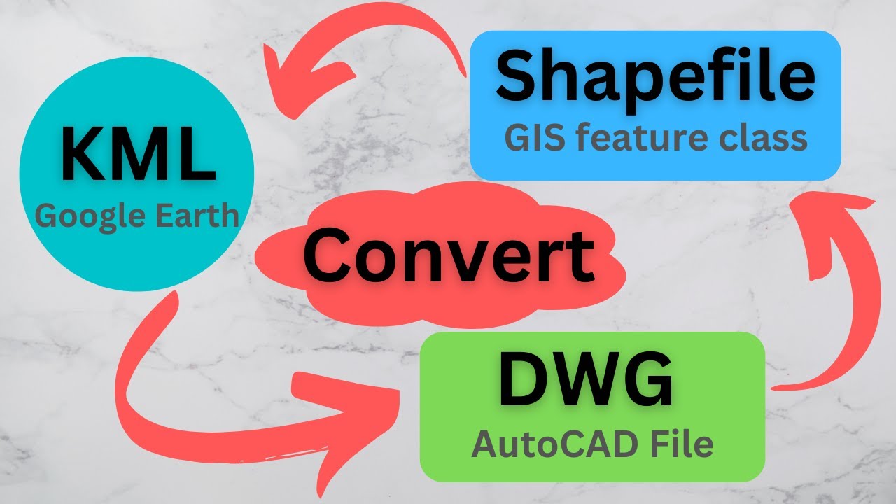
KML, CAD & Shapefile Conversion
We convert geospatial data between KML, CAD, and Shapefile formats with precision, ensuring compatibility, accuracy, and smooth integration across GIS platforms for seamless project execution.
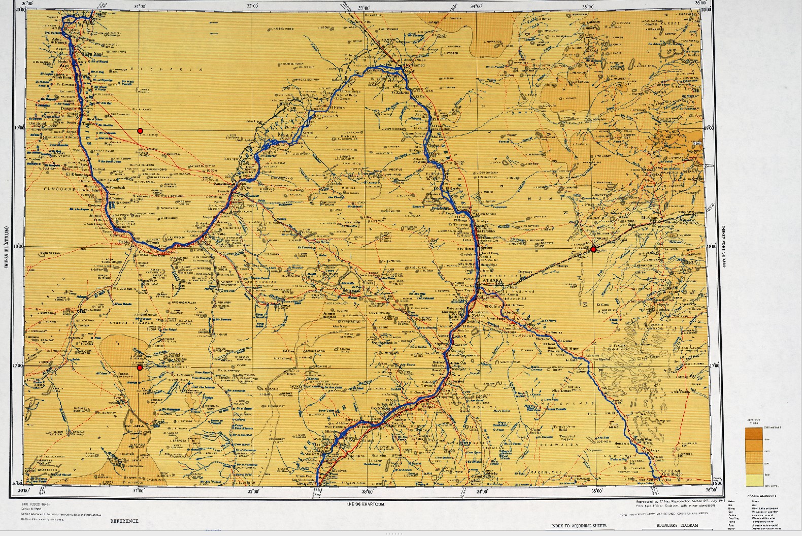
Georeferencing Scanned Maps
We accurately georeference old or scanned maps, aligning them with real-world coordinates to enable spatial analysis and integration into GIS systems for better decision-making and mapping clarity.
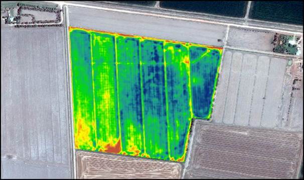
Satellite Interpretation (NDVI)
Our NDVI analysis from satellite imagery helps monitor vegetation health, land use, and crop conditions, offering insights for agriculture, forestry, and environmental management using modern remote sensing techniques.
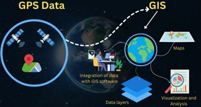
GPS Data Integration
We collect and integrate GPS data into your GIS projects to ensure precise location tracking, mapping, and spatial analysis — ideal for asset management, routing, and field operations.

Mapping & OSINT
We provide customized mapping services using open-source intelligence (OSINT) for risk assessment, surveillance, and planning — combining public data with expert analysis for strategic geospatial insights.
Streamline your operations with RemoteAnchor GIS Experts
Get Precise, Scalable Geospatial Solutions — Fast Turnaround, Custom Mapping, and Data-Driven Insights You Can Trust!
Starter GIS Pack
Best for: Civil Planners, Builders, Architects
- KML / CAD File Conversion – $25
- Basic Map Digitization – $25
- Georeferencing of 1–2 Scanned Maps – $29
- Output Format: DWG, SHP, or PDF
Mapping & OSINT
Best for: Journalists, Investigators, Policy Analysts
- Satellite-Based Location Analysis – $40
- OSINT Mapping (Conflict/Infrastructure) – $40
- Annotated KML / Interactive Map Layers – $30
- Visual Report in PDF – $30
GeoEnvironmental
Best for: NGOs, Agricultural Advisors, Climate Researchers
- NDVI / Vegetation Index Mapping – $50
- Land Use & Surface Type Classification – $40
- Elevation / Terrain Contour Map – $50
- Export in GeoTIFF / SHP / KMZ
